The first step in every environmental survey is the fauna and flora data inventory. A large amount of data collection methods are available but only the most suitable will be used to achieve all kind of survey according to each site particularities.
Fauna and flora
- Forested area- Mountain and alpine zones
- Wetland and riparian forests
")
")
")
")
")
")
")
")
")
")
")
")
")
")
")
")
")
")
")
")
")
")
")
")
")
")
")
")
")
 (Photo : Marie Le Roux)")
Habitat
- Forest type classification
- Vegetation community
- Habitats classification
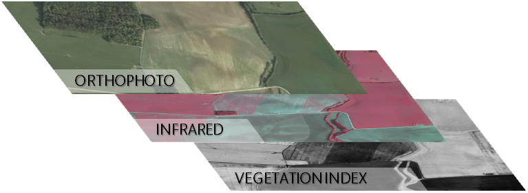
Field data must be then analysed to understand interaction in every ecosystem. Spatial analysis is a possible tool for decision making and biodiversity conservation.
Mapping
- Fauna and flora location
- Spatial analyses on GIS software
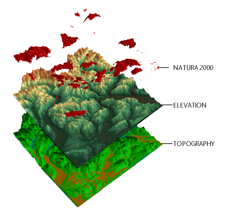
Spatial modelling
- Habitat suitability mapping.
- Landscape connectivity analyses
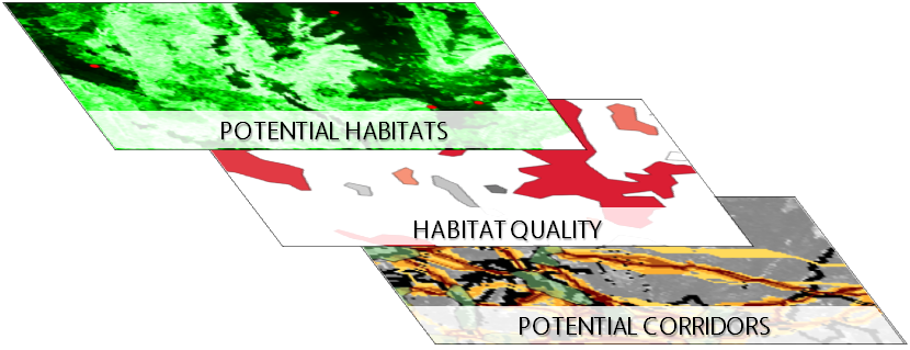
Statistics and image analyses
- Multivariate statistics
- Aerial and spatial images analyses
Natural habitat conservation and management
- Habitat quality assessment
- Ecosystems restoration
")
")
")
")
")
Human activities must be integrated into the environment. A way to achieve this goal is to share and show what can be done in term of conservation and protection of natural habitats.
Writing
- Technical guides
- Scientific articles
Design
- Photography
- Poster, exhibition, flyer...
Presentations
- For scientists: seminar, training
- For stakeholder: working groups, presentation
- To everyone: animation and mountain leading
At the office
PC designed for spatial and images analyses and modelling
Software: GIS, modelling tools, programming languages
On the field
Bat detector: Microphone Ultramic 250kHz and SoundChaser software
Digital single-lens reflex camera and numerical compact camera
GPS and other field work equipments